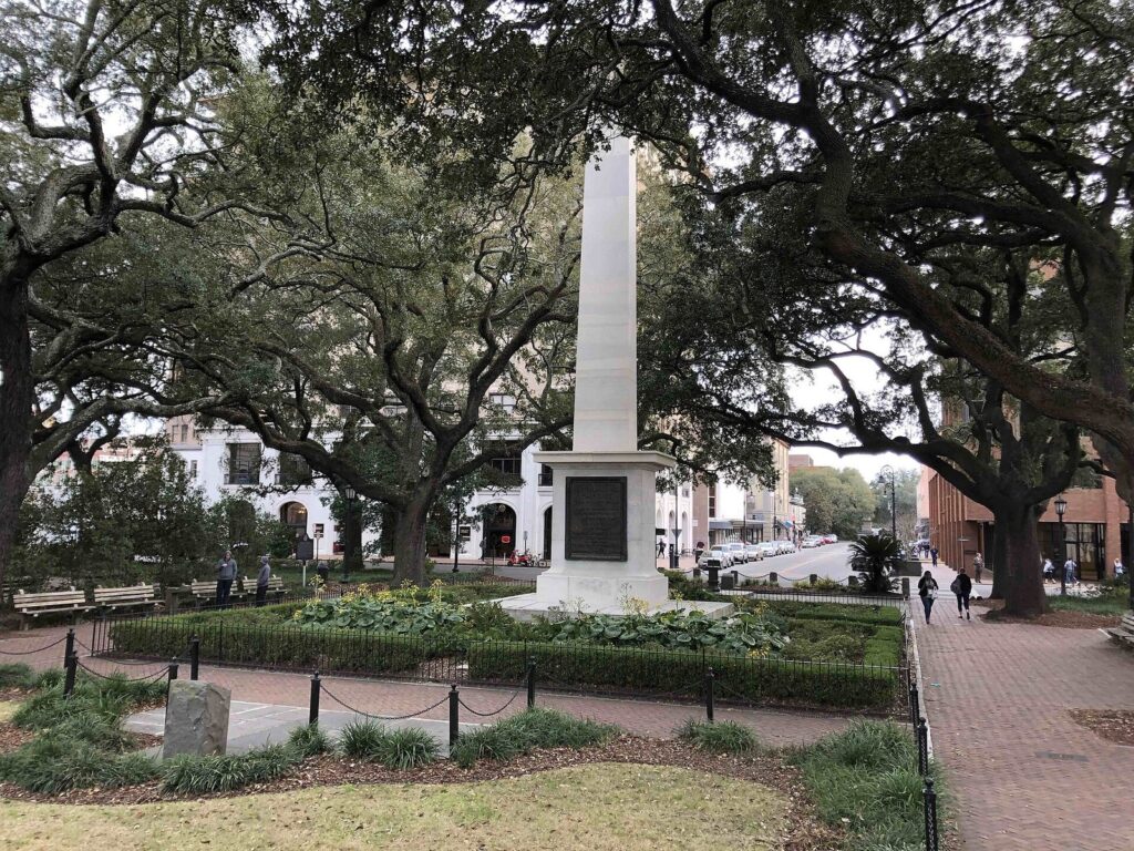
This Savannah Historic District guide starts with the shape of the place, because once you have it in your head, the rest of Savannah is easy. The National Historic Landmark district runs from the Savannah River south to Gwinnett Street, and from Martin Luther King Jr. Boulevard east to East Broad Street. Inside that rectangle is the street grid laid out from 1733, built around squares, 22 of which survive. Bull Street runs down the middle from City Hall to Forsyth Park, River Street and Bay Street form the northern edge, and Broughton Street is the main shopping street. South of Gwinnett Street, the grid carries on into the Victorian District, then the Thomas Square area and Starland, and beyond them Midtown and the early-1900s streets of Ardsley Park.
This guide is for visitors who want to understand the layout before they walk it: where each part of the district begins and ends, which walks are realistic in heat and on brick, and how to see it all if stairs or long distances are a problem. One caveat: “Historic District” gets used loosely. Hotels outside it sometimes use the name, and even published sizes for the district disagree, so this page sticks to the named boundaries. Everything here was checked September 23, 2026 against official sources.
The Historic District and Its Neighbors at a Glance
| Area | Where | Character | From Johnson Square |
|---|---|---|---|
| River Street and Factors Walk | Below the bluff at the district’s north edge | Cobblestones, old cotton warehouses, bars and the river | A few minutes’ walk, down stairs or ramps |
| City Market and Broughton Street | The northwest and middle of the district | Shops, galleries, restaurants | 5 to 10 minutes |
| The squares | Throughout, on six north-south lines | Small parks framed by houses and churches | You’re in one |
| Forsyth Park | The district’s southern edge | The big park and its fountain | About 20 minutes along Bull Street |
| Plant Riverside and Eastern Wharf | The west and east ends of the riverfront | Newer developments with hotels, riverwalks and green space | 10 to 20 minutes |
| Victorian District | Gwinnett Street south to Anderson Street | Wooden 19th-century houses, quiet streets | 25 to 35 minutes |
| Thomas Square and Starland | Anderson Lane south to Victory Drive | Galleries, restaurants, food trucks | 35 to 50 minutes, or a short ride |
| Ardsley Park and Midtown | South of Victory Drive | Early-1900s residential streets | A drive or rideshare |
| Hutchinson Island | Across the river | Convention center and a resort hotel | A free ferry ride |
| Isle of Hope and the Moon River District | About 20 minutes south by car | Marsh views, Bluff Drive, Wormsloe nearby | A drive |
Where the Historic District Begins and Ends
Savannah’s Historic District became a National Historic Landmark district in 1966, and its boundary was revised in 1977. The named boundaries are simple: the Savannah River to the north, East Broad Street to the east, Gwinnett Street to the south and Martin Luther King Jr. Boulevard to the west. That puts the northern half of Forsyth Park inside the district and the southern half outside it, which surprises people. Published figures for the district’s size disagree, so we don’t quote one. It’s small enough that you can walk from the river to the park in about 20 minutes without stopping.
Other lines matter more to visitors than the landmark boundary does:
- The to-go cup zone runs from the river south only to Jones Street, and west to the Talmadge Bridge and West Boundary Street. Monterey Square and Forsyth Park are outside it.
- The parking meters run longer north of Liberty Street (Monday to Saturday, 8am to 8pm) than south of it (Monday to Friday, 8am to 5pm).
- The Victorian District starts at Gwinnett Street and runs south to Anderson Street.
- The Thomas Square Streetcar district runs from Anderson Lane south to Victory Drive, and it includes Starland.
A map you can carry in your head
The district is a grid, and knowing the order of the streets is most of the navigation you’ll need. Bull Street is the spine, with the squares strung along it and along five other north-south streets.
| Direction | Streets, in order |
|---|---|
| North-south, west to east | Martin Luther King Jr. Blvd, Montgomery, Jefferson, Barnard, Whitaker, Bull, Drayton, Abercorn, Lincoln, Habersham, Price, Houston, East Broad |
| East-west, river to park | Bay, Bryan, Congress, Broughton, State, York, Oglethorpe Avenue, Hull, Perry, Liberty, Harris, Charlton, Jones, Taylor, Gordon, Gaston, Huntingdon, Hall, Gwinnett |
If you know which of those streets you’re on, you know roughly where you are: Bay Street is the river’s edge, Broughton is shopping, Liberty is the halfway point for meters, Jones is the edge of the to-go zone, and Gaston is the top of Forsyth Park.
How the Plan Came to Be
Georgia’s first colonists, led by James Oglethorpe, landed on the bluff in February 1733, and the town they laid out is still the one you walk today. Oglethorpe’s plan organized Savannah into wards, each built around a square. On the east and west sides of each square were trust lots, reserved for public buildings and churches; to the north and south were tything lots for houses. As the town grew, it added wards on the same pattern, ward by ward, until 24 squares filled the grid.
The plan’s elegance hid a harder history. Georgia’s Trustees banned slavery at first, but the ban was lifted in 1751, and by the 1800s much of the city’s wealth, from the cotton warehouses on the river to many of the finest houses on the squares, rested on the labor of enslaved people. In December 1864, Union troops under William T. Sherman took Savannah at the end of the March to the Sea, and Sherman famously offered the city to President Lincoln as a Christmas present. The old city survived largely intact.
The next threat came from the city itself. In the 1950s, the demolition of the old City Market building for a parking garage on Ellis Square, and the threatened loss of the Davenport House, pushed residents to found the Historic Savannah Foundation in 1955, and preservation became civic policy. Elbert and Liberty squares were lost to 20th-century road widening, but Ellis Square was reclaimed and restored in 2010, and the district became a National Historic Landmark in 1966.
The Squares, Column by Column
Of the 24 squares in the old plan, 22 survive. Elbert and Liberty were lost, and Ellis Square was restored in 2010. They sit in six north-south lines, which is the easiest way to explore them: pick a line and walk it end to end.
| Street | Squares, north to south | Look for |
|---|---|---|
| Bull Street | Johnson, Wright, Chippewa, Madison, Monterey | The Nathanael Greene monument in Johnson; the Oglethorpe statue in Chippewa; the Sorrel-Weed House on Madison; the Mercer Williams House and Pulaski monument on Monterey |
| Barnard Street | Ellis, Telfair, Orleans, Pulaski, Chatham | City Market beside Ellis; the Telfair Academy and Jepson Center on Telfair Square |
| Montgomery Street | Franklin | First African Baptist Church; Liberty and Elbert squares, farther south, were lost |
| Abercorn Street | Reynolds, Oglethorpe, Lafayette, Taylor | The Olde Pink House on Reynolds; the Owens-Thomas House on Oglethorpe; the Cathedral Basilica, Andrew Low House and Flannery O’Connor home on Lafayette; Taylor Square, renamed from Calhoun in 2023 |
| Habersham Street | Warren, Columbia, Troup, Whitfield | The Davenport House and the Kehoe House on Columbia |
| Houston Street | Washington, Greene, Crawford | Quieter residential squares on the district’s east side |
Taylor Square is the newest name on the map. City Council voted in August 2023 to rename Calhoun Square for Susie King Taylor, the Civil War nurse and teacher, and it was dedicated on February 10, 2024. Older maps and apps may still show the old name.
Squares with stories
- Johnson Square is the oldest, laid out in 1733, and its obelisk marks the grave of Revolutionary War general Nathanael Greene.
- Wright Square holds a memorial to Tomochichi, the Yamacraw leader who negotiated with Oglethorpe and is buried in the square.
- Chippewa Square has Daniel Chester French’s 1910 statue of Oglethorpe. It’s also where the bench scenes in Forrest Gump were filmed; the prop bench is now in the Savannah History Museum.
- Madison Square is framed by the Sorrel-Weed House and the Green-Meldrim House, which served as Sherman’s headquarters in the winter of 1864-65.
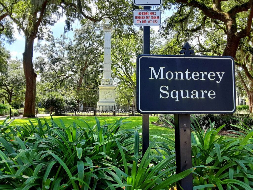
- Monterey Square has the Pulaski monument, the Mercer Williams House and Congregation Mickve Israel’s Gothic Revival synagogue.
- Lafayette Square gathers the Cathedral Basilica, the Andrew Low House, the Hamilton-Turner Inn and the Flannery O’Connor Childhood Home around one small park.
- Ellis Square is the comeback story: a parking garage for half a century, restored as a square in 2010 beside City Market.
Realistic Walks Through the District
The district is flat, but it isn’t effortless. Sidewalks are brick and tilt where oak roots have lifted them, River Street is cobblestone, and the bluff between Bay Street and River Street is steep. From June through September, walk early or late; the average July high is 92.3°F. Each walk below lists a distance, the surface and an alternative for anyone who can’t do it on foot.
1. Bull Street, river to fountain
From City Hall on Bay Street, walk south through Johnson, Wright, Chippewa, Madison and Monterey squares to the Forsyth Park fountain. It’s about a mile: 20 minutes without stopping, an hour or two with the stops you’ll want to make.
Surface: brick sidewalks and paved paths through the squares. Alternative: the free DOT Express Shuttle’s Forsyth loop covers the same stretch, with buses about every 10 minutes (7am to 7pm on weekdays, 10am to 6pm on weekends).
2. River Street and Factors Walk
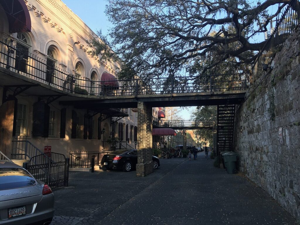
Go down to River Street from Bay Street, walk east to the Waving Girl statue in Morrell Park, then back west past City Hall toward Plant Riverside. On the way back up, look at Factors Walk, the lane of iron bridges and old cotton offices built into the bluff between the two streets. Allow an hour.
Surface: cobblestones on River Street, steep ramps and very steep old stairs up the bluff. Alternative: use the public elevators between the Hyatt and City Hall or at The Alida, and ride the free Savannah Belles Ferry, which is ADA accessible, between the City Hall and Waving Girl landings.
3. The east-side squares
Start at Reynolds Square, then zigzag east and south through Warren, Washington, Columbia, Greene, Crawford and Oglethorpe squares, finishing at Colonial Park Cemetery and Lafayette Square. It’s roughly 1.5 miles and passes the Davenport House, the Owens-Thomas House and the Cathedral Basilica, so pair it with a house tour.
Surface: brick sidewalks, some uneven. Alternative: a trolley overview; Old Town Trolley and Old Savannah Tours both have lifts on many vehicles with 24 hours’ notice.
4. The west-side squares and City Market
From Ellis Square and City Market, walk to Franklin Square for First African Baptist Church, then south along Barnard Street through Telfair, Orleans, Pulaski and Chatham squares. Roughly 1.5 miles, with the Telfair museums and Ships of the Sea close by.
Surface: brick sidewalks and City Market’s pedestrian courtyards. Alternative: the DOT Express Shuttle’s Downtown loop.
5. Forsyth Park to Starland
From the park’s south end, head south through the Victorian District’s streets of wooden houses to the Starland District around Bull Street and 40th Street. About a mile, and best in the late afternoon, ending at Starland Yard’s food trucks (open from 5pm Monday to Thursday and from noon Friday to Sunday).
Surface: ordinary city sidewalks, with more traffic than the squares. Alternative: a rideshare; after dark it’s the better choice anyway.
6. Jones Street and the southern squares
Walk Jones Street east from Bull Street to Abercorn Street, one of the quietest residential blocks in the district, and detour a block north to Lafayette Square for the Cathedral Basilica. Then head south through Taylor Square on Abercorn and Whitfield Square on Habersham, and loop back west along Gordon Street to Monterey and Chatham squares. Roughly 1.5 miles, mostly residential, with little traffic and plenty of shade.
Surface: brick sidewalks, shaded and uneven in places. Alternative: a trolley overview, with lifts on many vehicles if you call 24 hours ahead.
An Architecture Field Guide
You don’t need to know architectural styles to enjoy the district, but a few labels make a walk more rewarding, because Savannah shows almost two centuries of American building in a few square blocks.
| Style | How to spot it | Where to see it |
|---|---|---|
| Georgian | Symmetrical, boxy, with a centered door | The Olde Pink House on Reynolds Square, built in 1771 |
| Federal | Refined brick, fanlights over the door, delicate trim | The Davenport House on Columbia Square |
| English Regency | Smooth stucco, curved walls, restrained ornament | The Owens-Thomas House, the Telfair Academy and the Scarbrough House at Ships of the Sea, all by architect William Jay |
| Gothic Revival | Pointed arches, spires, tracery | The Cathedral Basilica on Lafayette Square and Mickve Israel’s synagogue on Monterey Square |
| Italianate | Deep bracketed cornices, arched windows | The Mercer Williams House on Monterey Square |
| Second Empire | Mansard roofs, heavy window hoods | The Hamilton-Turner Inn on Lafayette Square |
| Queen Anne and Victorian | Turrets, bays, porches, decorative trim | The Kehoe House on Columbia Square and the wooden houses of the Victorian District |
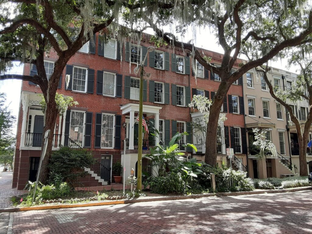
Look down as well as up. Raised first floors with tall double stoops are a Savannah signature, iron balconies and railings run through the older blocks, and the stone and brick of Factors Walk and River Street show the working side of a port city.
The Main Streets and Waterfront Inside the District
River Street and Factors Walk
The riverfront is the district’s busiest stretch: restaurants and bars in old cotton warehouses, the Waving Girl statue at the east end, and the ferry landings. It sits inside the to-go cup zone, so evenings run late. Factors Walk, just above, is quieter and more interesting architecturally, with its bridges and stone ramps.
City Market and Broughton Street
City Market is four blocks of restored warehouses on West St. Julian Street beside Ellis Square, with restaurants, shops, galleries and the upstairs Art Center; the market lists daily hours of 10am to 6pm. Broughton Street, a few blocks south of the river, is downtown’s main shopping street, with Leopold’s Ice Cream at 212 E. Broughton.
Plant Riverside District
At the west end of River Street, a former power plant is now a hotel-and-entertainment complex. Anyone can walk through its Generator Hall, with a 135-foot dinosaur, fossils and minerals, and along a quarter-mile riverwalk. District Live concerts are ticketed.
Eastern Wharf
At the other end of the riverfront, Eastern Wharf is a 54-acre development billed as an extension of River Street, with parks, shops, restaurants, residences and the Thompson Savannah hotel. The Park at Eastern Wharf, a riverfront green beside the hotel, is reachable on foot along the Riverwalk or from General McIntosh Boulevard and East President Street.
Forsyth Park
The district’s big park, with its 1858 fountain running again since December 19, 2025, after its first major restoration since 1988. A new Shade Garden opened on the west side in February 2026, and the Forsyth Farmers’ Market fills the south end every Saturday from 9am to 1pm.
Neighborhoods Beyond the Historic District
Victorian District
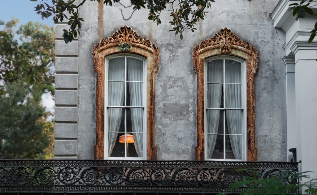
Directly south of Gwinnett Street, the Victorian District runs to Anderson Street, a neighborhood of 19th-century wooden houses with porches and gingerbread trim. It’s residential and quiet, with few big hotels, so visitors who stay here mostly use vacation rentals, which the City allows under its short-term rental rules.
Thomas Square and Starland
South of Anderson Lane, the Thomas Square Streetcar district runs to Victory Drive. Its liveliest corner is the Starland District, the Bull Street strip between 37th Street and Victory Drive, named for the old Starland Dairy, whose building stands on Bull between West 40th and West 41st streets. After the dairy closed in the late 1980s, SCAD graduates began reusing the building in the late 1990s, and the area now has galleries, restaurants such as Ukiyo, and the Starland Yard food-truck lot.
Midtown and Ardsley Park
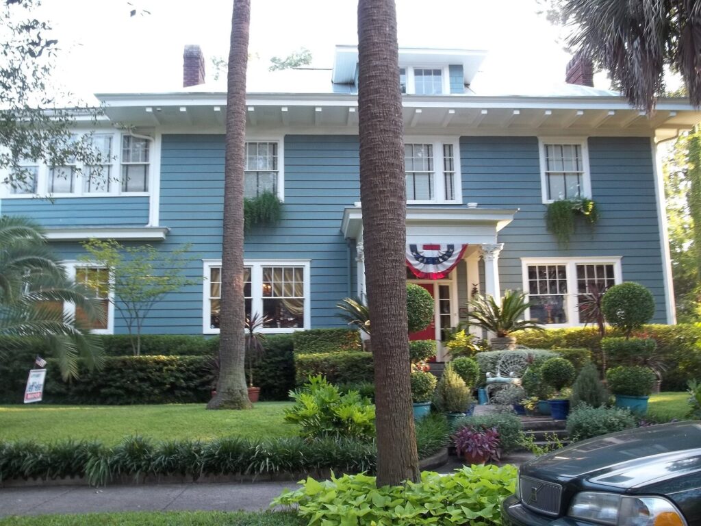
South of Victory Drive, Midtown is where most of Savannah lives. Its showpiece for visitors is the Ardsley Park-Chatham Crescent Historic District, listed on the National Register in 1985: roughly 400 acres of early-1900s houses between Victory Drive, 54th Lane, Bull Street and Waters Avenue, developed from 1909 and 1910 as two subdivisions. It’s a pleasant drive or bike ride under the oaks rather than a sightseeing district, and it has no attractions to plan around.
Hutchinson Island
Across the river from City Hall, Hutchinson Island has the convention center and The Westin Savannah Harbor Golf Resort & Spa. The free Belles Ferry crosses from 7am to 10pm, and the view back across to the city is the best of the riverfront’s.
Isle of Hope and the Moon River District
About 20 minutes south by car, the Moon River District, named for the Johnny Mercer song, covers the marsh communities along the Moon and Skidaway rivers: Isle of Hope, Skidaway Island, Sandfly and Ossabaw Island. Isle of Hope, a small inland island about 8 miles from downtown, grew as a summer retreat from the 1840s, and its Bluff Drive has historic houses, big live oaks and views over the Intracoastal Waterway. Wormsloe State Historic Site and the Pin Point Heritage Museum are nearby.
Which Neighborhood Suits Your Trip?
| If you want | Spend your time in |
|---|---|
| Everything on foot, first visit | The squares between River Street and Liberty Street |
| Quiet streets and house museums | The squares south of Liberty Street and around Forsyth Park |
| Nightlife | River Street and City Market |
| Local restaurants and galleries | Starland and the Victorian District |
| River views and new riverwalks | Plant Riverside, Eastern Wharf and Hutchinson Island |
| Marsh, oaks and history outside the city | Isle of Hope, Wormsloe and the Moon River District |
| A slow drive past early-1900s houses | Ardsley Park |
If you’re choosing a place to sleep as well as a place to explore, our guide to where to stay in Savannah compares each area on noise, parking and walking distance.
The District by Time of Day
- Early morning: the squares are cool and quiet, the light is soft, and River Street is nearly empty. It’s the best time for photographs and for long walks in summer.
- Midday: the heat builds from late spring to early fall, so this is the time for the house museums, the Telfair’s galleries and a long lunch.
- Late afternoon: Forsyth Park fills with locals, and the light through the oaks is at its best on the southern squares.
- Evening: River Street and City Market get busy, ghost tours move through the squares, and the line at Leopold’s grows. The residential squares stay quiet.
- Sunday morning: church bells, fewer cars and free street parking. Several house museums open later on Sundays, so it’s a good morning for a walk instead.
The District With Kids
The squares are made for children who need to run between stops, and the district has a few sure things: the free ferry ride across the river, the 135-foot dinosaur in Plant Riverside’s Generator Hall, Leopold’s on Broughton Street, and the fountain and open lawns of Forsyth Park. The Juliette Gordon Low Birthplace is the obvious house museum for young Girl Scouts, and the trolleys give tired legs a break. Keep walks short in summer, and plan a sit-down stop every half hour.
Getting Around the District: Surfaces, Slopes and Access
- Brick and cobblestones: brick sidewalks run through most of the district, and they tilt where roots have lifted them. River Street and Factors Walk are cobblestone.
- The bluff: the drop from Bay Street to River Street is steep. The public elevators between the Hyatt and City Hall and at The Alida are the only step-free, ramp-free links.
- Free rides: the DOT Express Shuttle (two loops, 18 stops, about every 10 minutes) and the Belles Ferry are both free and ADA accessible.
- Trolleys with lifts: Old Town Trolley and Old Savannah Tours have lifts on many trolleys with 24 hours’ notice.
- Breaks: the visitor centers on River Street (1 W. River Street, daily 10am to 6pm) and in City Market (307 W. Julian Street, daily 10am to 5pm) are useful stops for maps and a rest.
- Driving: park once in a City garage ($2 an hour at Bryan Street, Robinson and State Street, with a $20 weekday maximum and $5 flat on weekends) and walk.
For the attractions along these walks, with prices, hours and access notes for each, see our directory of Savannah attractions and landmarks.
Where to Start, Park and Rest
Start at Johnson Square if you’re walking, or at the MLK Visitor Information Center on Martin Luther King Jr. Boulevard (daily 9am to 4pm) if you want a paper map and a restroom first. If you’re driving, the City’s garages put you close to different parts of the district: Bryan Street for the river and Johnson Square, Robinson for the Telfair museums and City Market, State Street for Broughton Street and the middle squares, and Liberty Street ($1 an hour, $14 maximum) for the southern half. The visitor centers on River Street and in City Market are the easiest mid-walk stops, and the DOT Express Shuttle’s 18 stops mean you’re rarely far from a free ride back.
Rules Worth Knowing Inside the District
The squares are public parks, but most of the buildings around them are private homes, offices and churches. Admire the ironwork from the sidewalk, stay off stoops and out of gardens, and keep voices down on residential blocks at night, when tour groups pass through. Inside the to-go zone, adults 21 and over can carry one drink in a paper, plastic or aluminum cup of 16 ounces or less, with no glass, cans or bottles. Short-term rentals need a City certificate and are limited to the Downtown, Victorian and Streetcar historic districts, so if you’re renting, ask the host for the certificate before you pay.
Common Mistakes in the Historic District
- Driving from square to square. One-way streets and meters make it slower than walking. Park once.
- Stopping at River Street. The riverfront is one strip of the district, and the squares south of Broughton Street are where Savannah looks most like itself.
- Skipping the south half. The squares below Liberty Street are quieter and, for many visitors, the most beautiful.
- Walking Bull Street at noon in July. Go early, go late, or ride the shuttle.
- Assuming your drink is legal everywhere. The to-go zone stops at Jones Street, and Monterey Square and Forsyth Park are outside it.
- Trusting an old map. Calhoun Square is Taylor Square now, and Ellis Square is a square again, not a garage.
- Climbing stoops for photos. Most are someone’s front steps.
Savannah Historic District FAQ
What are the boundaries of the Savannah Historic District?
The National Historic Landmark district is bounded by the Savannah River to the north, East Broad Street to the east, Gwinnett Street to the south and Martin Luther King Jr. Boulevard to the west. That puts the northern half of Forsyth Park inside it. The Victorian District begins south of Gwinnett Street.
How long does it take to walk the Savannah Historic District?
Walking Bull Street from City Hall to the Forsyth Park fountain takes about 20 minutes without stops and covers roughly a mile. Seeing the squares properly takes a full day, or two half days, because each has something to stop for. In summer, walk early or late and use the free DOT Express Shuttle in the middle of the day.
How many squares are in Savannah?
Twenty-two of the 24 squares in the original town plan survive. Elbert and Liberty squares were lost, and Ellis Square was restored in 2010. Calhoun Square was renamed Taylor Square in 2023, for Civil War nurse and teacher Susie King Taylor, so some older maps still show the old name.
Is the Savannah Historic District wheelchair accessible?
Partly. The squares are flat, but brick sidewalks are uneven, River Street is cobblestone and the bluff is steep. The public elevators between the Hyatt and City Hall and at The Alida link Bay Street and River Street, and the free DOT Express Shuttle and Belles Ferry are ADA accessible. Trolley tours have lifts with 24 hours’ notice.
What is the difference between the Historic District and the Victorian District?
The Historic District is the original grid of squares from 1733 onward, between the river and Gwinnett Street. The Victorian District, directly south from Gwinnett Street to Anderson Street, grew later and is known for wooden 19th-century houses with porches and decorative trim. It has no squares from the original plan and is quieter and more residential.
Where is the Starland District?
Starland sits within the Thomas Square Streetcar district, south of the Victorian District, along Bull Street between 37th Street and Victory Drive. It takes its name from the old Starland Dairy building on Bull Street between West 40th and West 41st streets, and it’s known for galleries, restaurants and the Starland Yard food-truck lot.
Can you drink alcohol in the Savannah Historic District?
In part of it. Adults 21 and over can carry one drink in a paper, plastic or aluminum cup of 16 ounces or less inside the to-go zone, which runs from the river south to Jones Street. Glass, cans and bottles aren’t allowed, and Monterey Square and Forsyth Park are outside the zone, so finish your drink before you get there.
Related Savannah Guides
- Savannah Attractions and Landmarks: prices, hours and access for the sights in each neighborhood.
- Where to Stay in Savannah: each area compared as a base.
- Savannah Itineraries: day-by-day plans that follow these walks.
- Savannah Tours: guided walks and trolleys through the district.
- Savannah Restaurants and Local Food: where to eat in each neighborhood.
- Getting Around Savannah and Parking: shuttles, ferry, parking and event-day closures across the district
Sources and How We Checked
We checked this guide on September 23, 2026. It’s compiled from the National Park Service, the Library of Congress, the City of Savannah, the Historic Savannah Foundation and the other agencies and operators listed below, not from other travel guides, and it doesn’t claim first-hand visits. Walking times are our estimates for an unhurried pace.
- National Park Service: Savannah Historic District documentation
- Library of Congress: Savannah Victorian Historic District survey (HABS GA-1169)
- Historic Savannah Foundation: National Historic Landmark District, Victorian District, Ardsley Park-Chatham Crescent, Isle of Hope
- Historical marker: Savannah Historic District marker text
- City of Savannah: City Code on to-go cups, parking meters, parking garages, short-term vacation rental regulations
- Neighborhoods: Thomas Square Neighborhood Association, The Park at Eastern Wharf, Eastern Wharf, Plant Riverside District, City Market, Moon River District
- Getting around: DOT Express Shuttle, Savannah Belles Ferry, Old Town Trolley accessibility, Old Savannah Tours, visitor information centers
- News: WTOC on Taylor Square, WTOC on the Forsyth Park fountain, WTOC on the Shade Garden
- Food and markets: Starland Yard, Leopold’s Ice Cream, Forsyth Farmers’ Market
- NOAA: 1991-2020 climate normals for the Savannah airport
Savannah Tourism Guide is an independent publication. We are not affiliated with Visit Savannah, the City of Savannah or any attraction listed here, and no one paid to be included.
Photo Credits
- Johnson Square: photo by Tjbliss, Wikimedia Commons (CC BY 4.0)
- Monterey Square: photo by JeffersonLH, Wikimedia Commons (CC BY-SA 4.0)
- Factors Walk: photo by Seasider53, Wikimedia Commons (CC BY-SA 4.0)
- Ardsley Park-Chatham Crescent house: photo by Ebyabe, Wikimedia Commons (CC BY-SA 3.0)
- Jones Street row houses: photo by JeffersonLH, Wikimedia Commons (CC BY-SA 4.0)
- Victorian District house detail: photo by Photoartel, Wikimedia Commons (CC BY-SA 3.0)